
"During this time, many settlers came from Eastern Canada, and the Eastern States, as well as the British Isles, to begin a new life, in a new country...They traveled by boat and rail to St. Vincent, Minnesota, crossed the Red River by ferry to Pembina; then progressed by ox-carts or wagons, toward the virgin prairie and along wooded streams where they established homes, with the Homestead, Preemption and Tree Claim Rights..." - From The Early History of Bathgate
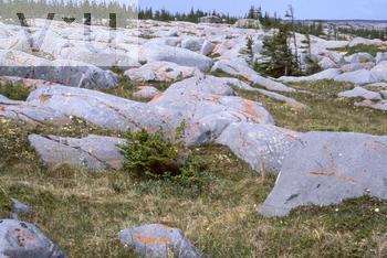 The Canadian Shield is a vast mass of exposed rock - as you might suspect, not easily traversed - so early travellers were forced to avoid it. It necessitated very long detours around and/or through the Great Lakes, for those that needed to go west from Eastern Canada. Many people that settled in and around St. Vincent took these routes. However, many simply passed through our area, as a matter of necessity, on their way further west. I think we can be safe to assume that the large numbers quoted by the Gambles in their letters, were no exaggeration, that they did indeed see hundreds and sometimes thousands of souls passing through the area for many weeks and months in the later 1800's...
No comments:
Post a Comment